Russian Colombs disregarding a somber fate
Will discover a new way to the East in the icy ocean
And our State will reach America…
M. Lomonosov
|
§ Russia
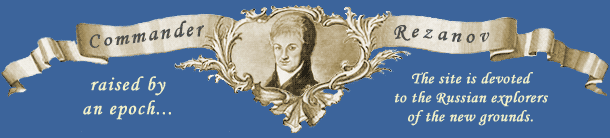
18th century. The Russian Empire broadly and freely stretches its shoulders and turns its eyes on the East on thousands of kilometers of free lands, where the savage tribes and the entire nations live among nature, and the great forces are hidden under the ground. Who will awake these forces? Who were the countless riches prepared for? For whom are these infinite lands and waters, this space and this sky? Where and why did Shelikhov, Rezanov, Kuskov, Baranov accompanied by thousands of unknown pioneers set out? What did they live for? And for the sake of what were their great deeds? What makes a man to leave a long -occupied place? What does he dream to see behind the horizon where the dark rocks are enveloped in watery clouds and the cold ocean is so majestically deserted?
Geographical discoveries of the russian travellers
in the 18th-19th centuries
1741
The Great North Expedition: on the “St. Paul” and the “St. Peter” A. Chirikov with V. Bering navigated to the east from Kamchatka where they discovered the shores of North-Eastern America and found a number of the Aleutian Islands on their way back.
1743-1744
Emelian Basov visited the Commander Islands and returned with rich loot.
1745
The “Russian Atlas” was compiled and published. It consisted of 19 special maps representing the All-Russian Empire with bordering lands.
1745-1746
Navigator M. Nevodchikov and frontiersman J. Chuprov spent the winter on the Near-Aleutian Islands. They drew up the map of Attu, Agatu, and Sanichi Isles.
1746
The General map of the Great North Expedition was drawn up by the Naval Academy.
1748-1749
N. Novikov, N. Shalaurov, I. Bakhov launched out an expedition in order to find a shipping route from Andir to Kamchatka.
1752-1754
Navigator Bashmakov reached the Andreanof Islands.
1755
“The Description of Kamchatka” by S. P. Krasheninnikov was published.
1757
Navigator Bashmakov visited the Rat Islands.
1758-1759
Irkutsk merchant Bechevin designed the project of the navigation from Okhotsk to Kamchatka and then to the Lena River round Chukot Peninsula (this project wasn’t realized).
1759
M. V. Lomonosov gave the speech “The Discourse on the Accuracy of the Shipping Route”.
1759-1762
Stephan Glotov from Yarensky Posad visited the islands of Umnak and Unalashk and mapped them.
1760
Lieutenant-colonel F. Plenisner was appointed Chief Commander of the Anadir Region.
1760-1764
Selenga merchant Andrian Tolstikh researched the islands which were later given his name.
1761
The ship of merchant Bechevin reached Alaska and spent winter in the Isanakhs Strait.
1762-1763
Stephan Glotov was the first after Bering to visit Kadiak Island.
1762
The first (unsuccessful) navigation of I. Sindt was made to the shores of Northern America.
1763
M. V. Lomonosov presented Catherine II his work “A Short Description of Various Voyages in the Northern Seas and the Indicating of the Possible Shipping Route to Eastern India through the Siberian Ocean”, he also gave the Swedish Academy his “Ideas on Passing by the Icebergs in Northern Seas”. Sergeant Andreev navigated from Nizhnekolymsk to the Bear Islands for the first time.
1764-1767
I. Sindt’s expedition from Okhotsk to the Bering Strait was launched. In the period of navigation of 1766 on the “St. Catherine” the expedition managed to come close to the shore of America in the area of the Bering Strait. Island of Mathew was discovered (1766).
1764-1765
N. Daurkin was traveling through Chukotski Peninsula. He visited Island of Saint Lawrence and The Koluchinsk Bay.
Early 60-s, 18th century
Savva Loshkin sailed around New Zealand for the period of two navigations.
1765-1766
The first expedition headed by V. Y. Chichagov tried to find the north-eastern shipping route from Shpitsbergen to the Bering Strait.
17764-1771
The secret Russian expedition headed by Levashev and Krenitsin inventoried the American territories belonged to Russia and the ridges of the Aleutian Islands. The expedition was to draw them on the map.
1766
Merchant Vasiäli Shilov from Veliky Ustug presented Catherine II the map of the Aleutian Islands up to Amki Island (the Andreanof Islands). Yakov Chirakin navigated through the Strait of Matochkin Shar from the north to the east up to the Karsk Sea and drew the plan of the Strait.
1768
Suet and herring trade business of Shuvalov’s company was confiscated and given into privacy of the Arkhangelsk merchants.
1773-1779
Navigator Potap Zaikov sailed to the Aleutian Islands and was the first to draw the precise map of the islands.
1778-1779
The expedition of the Ost-Indus Company headed by D. Cook reached the shores of Russian America (Alaska), navigated through the Bering Strait to the North and visited Kamchatka.
1784
G. I. Shelikhov founded the settlement on Kadiak Island.
1785-1786
The North-Eastern Geography-Astronomical Naval Expedition headed by Billings was equipped.
1786
The project of the first voyage round the world with Capitan Mulovski in the head appeared (wasn’t realized). Navigator G. Pribilov discovered the group of islands which later received his name.
1787
The North-Eastern Expedition on the ships the “Pallas” and the “Yasashna” navigated to the east from the Kalyma River in order to find a shipping route to the Pacific Ocean. A French expedition headed by Laperuz was navigating in the waters of Far East.
1790
On the ship the “Three Saints” A. A. Baranov started from Okhotsk to the shores of the New World to be the first ruler of the part of America which was to become the property of Russia.
1790-1791
The North-Eastern Expedition on the frigate the “Glory of Russia” navigated to the shores of North-Western America, Alaska, and Chukotka.
1791
Navigator Bocharov described the northern shores of Alaska Peninsula and navigated to the southern shore.
1791-1792
I. Billings with a group of his accomplices launched a winter expedition from the Gulf of Saint Lawrence to Nizhnekolymsk through Chukotski Peninsula. He drew the first authentic map of Chukotka.
1792-1793
The books of “Russian merchant and distinguished citizen of Rilsk” G. I. Shelikov about his expeditions “by the Eastern Ocean to the American shores” in 1783-1788 were published.
1795
The decree on the end of Belling’s North-Eastern Geography-Astronomical Expedition was issued.
1795-1796
The delta of the Lena River was described by Efim Kozhevin.
1799
“The Russian-American Company” was established.
1803-1806
The first Russian voyage round the world was made on the ships the “Neva” and the “Nadezhda”. The expedition was headed by N. P. Rezanov, I. F. Kruzenshtern, U. F. Lisjansky.
1803-1853
The vessels of the Russian sailing fleet made 60 voyages round the world.
1804
Novoarchangelsk which was the residence of the main ruler of Russian lands in the North America was founded on Sitka Island.
1821
The expedition of the Russian-American Company headed by Khromchenko on the brig the “Golovin” described the north-eastern shores of Alaska. Russian Government forbade the navigation of the foreign vessels in the Pacific Ocean northward of 51’NL.
1838
The expedition of the Russian-American Company headed by Kashevarov on the brig the “Polifem” described the northern coast of Alaska from Lisbern Promontory to Barrow Promontary.
1840
On the brig of the Russian-American Company the “Chichagov” Etolin launched the expedition from Novoarkhangelsk to the Bering Strait and to the Gulf of Saint Lawrence.
1842-1844
Lieutenant L. A. Zagoskin researched the basins of the Kvikhpack (Ukon) and the Kuskoquim Rivers and compiled a description of the considerable part of Russian America made during the traveling.
1867
The Tsar’s Government sold Alaska and the Aleutian Islands which were the privacy of the Russian-American Company.
Other sources about Russia in N. P. Rezanov’s epoch
Translated by Anna Alexeeva
| |